By Carol Stiffler
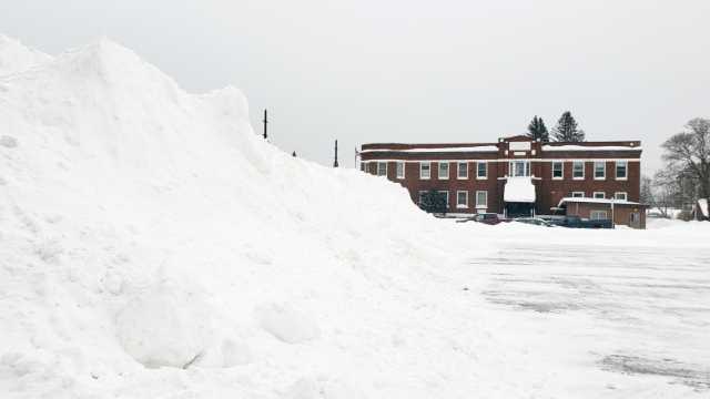
Last week’s shock-and-awe snowfall came during an already very snowy winter in the Tahquamenon area. Business signs, like at the Secretary of State office, are buried. Stop signs appear to be held up solely by snow. Easing through intersections requires a slow roll and a careful peek.
Though it seems like this is more snow than we’ve had for decades, it’s not.
“This is actually kind of a normal winter,” said Greg Michels, meteorologist for the National Oceanic and Atmospheric Administration (NOAA) in Marquette. “The last couple winters we’ve had have been very different. Last year was pretty quiet and warm.”
That’s what has made this year look excessively snowy, he said.
“I think what’s striking a lot of people is the fact that last year was pretty low for snowfall totals, and quieter than normal,” he said. “It might seem like it’s been a more harsh winter than it has been.”
It’s also not matching up with the pre-season Farmer’s Almanac prediction, which called for a warmer, wetter winter.
The snow that’s landing on us is coming from Lake Superior and sometimes Lake Michigan, Michels said.
Jim Salzwedel, NOAA observation program leader in Marquette, said the lakes create bands of snow that function like roads to direct snow right onto Newberry at times.
“If you’re under one of those narrow bands of snow, it can be like a wall of snow or a curtain of snow,” Salzwedel said. “That frequently happens in the Newberry area, and across the whole U.P., especially the north half.”
Though the snowfall this winter doesn’t exceed the norm, it has been difficult to predict. Meteorologist Karl Bohnak said Lake Superior is only about 35% frozen over as of this week, and Lake Michigan isn’t frozen over, either. Airflow over those Great Lakes can cause an unexpected amount of snow to fall in Newberry.
Village residents saw that last week, after weather forecasts predicted a few inches of snow here on Friday, but a bombshell of more than 12 inches fell instead.
“You had help off of Lake Michigan out of that storm,” Bohnak said. “The wind was blowing out of the south.”
As for the expected major snow event this week, winds from the west dropped 16 inches of snow at the National Weather Service in Negaunee in just 24 hours, with another 16 inches of snow expected to accumulate by the end of today. Newberry expected to receive just a few inches.
Snowfall observations for Newberry are now recorded by the Luce County Road Commission. As of Monday, February 21, Newberry had received a rough estimate of 75 inches of snow this winter.
Snow measurements are not simply taken with a ruler, but also through melting each snow reading to measure its water content. Readings are done at the same time each day, and it takes a disciplined sort of person to commit to that.
“With snow and winter observation, it takes perseverance and dedication,” Salzwedel said. Snow gauges are out in the open, which can mean trudging through drifts to reach them.
In addition to the readings from the road commission, Salzwedel said NOAA would be very interested in having a similar reading from a CoCoRaHS observer. CoCoRaHS is short for Community Collaborative Rain Hail & Snow Network, and it’s based out of Colorado.
For more information, or to join the CoCoRaHS community, visit cocorahs.org.